
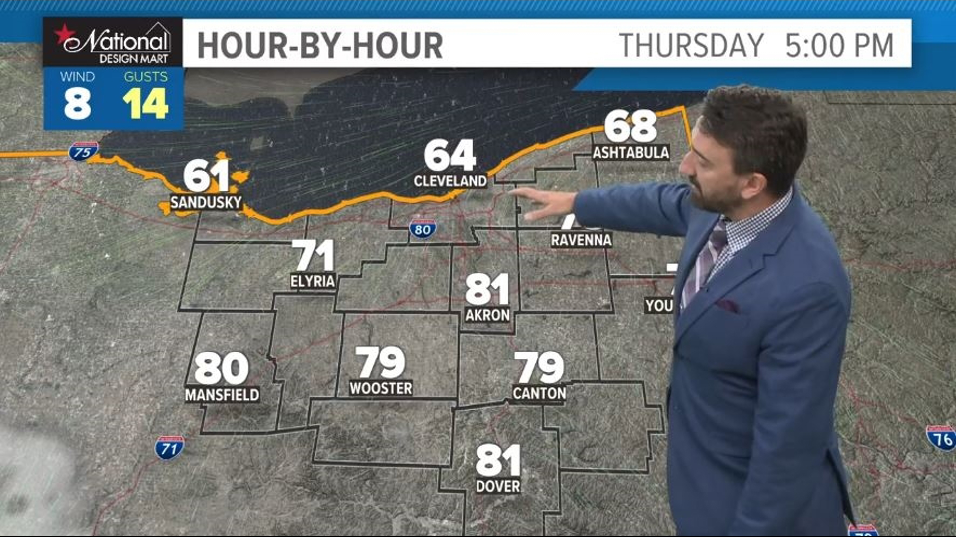
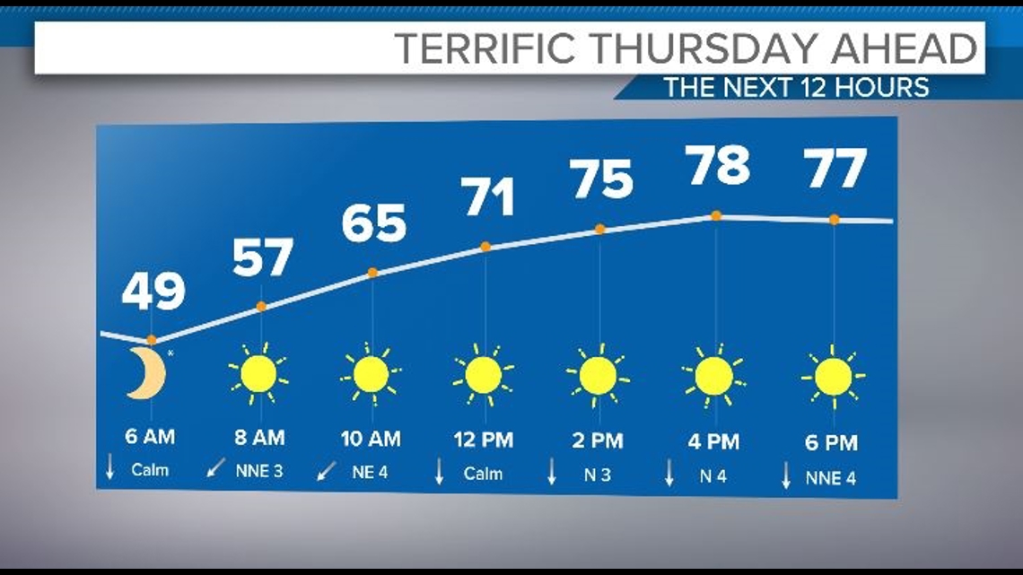
CLEVELAND — We're in store for an absolutely beautiful day today as high pressure remains in brief control, providing us plenty of sunshine before some high clouds begin to move in from the west. Temps today will range from near 80 away from the lake to the upper 60s near the lake as a decent lake breeze develops this afternoon.

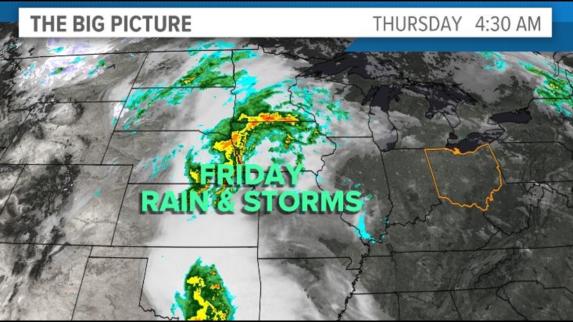
Clouds will begin to increase tonight as we introduce rain chances with the approach of our next storm system from the west. Rain and storms will develop during the day Friday with increasing humidity and highs pushing into the low and even mid 80s if we can squeak out some sunshine before the rain arrives.

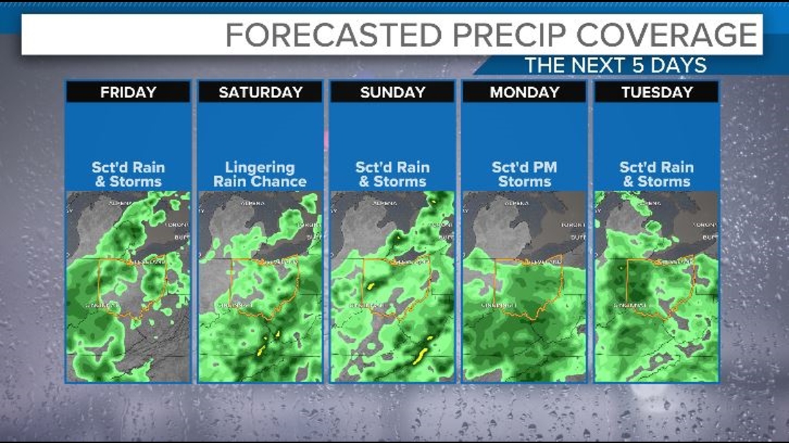
We'll remain unsettled through the weekend with lingering rain chances Saturday and a renewed shower and storm chance Sunday as a new wave of low pressure approaches. Our pattern will remain very summer-like with daily rain and storm chances and dry hours in between. Humidity will remain around, too, with highs in the 70s through the middle of next week.

THE 3 DAY FORECAST
TODAY: Mainly sunny and pleasant. Highs in the upper 70s but cooler near the lake.
FRIDAY: Increasing clouds with rain and storms developing. Low 80s.
SATURDAY: Lingering rain chances, otherwise variable clouds. Low 70s.
Here are some quick weather resources you can use:
---------------------------------------------------------------------------------------------------
Get more weather from the 3News Weather team of Betsy Kling (@betsykling), Matt Wintz (@WintzWeather), Anthony Copeland (@WeatherManAC) and Hollie Strano (@holliesmiles)
►MORE WEATHER | Get the latest weather headlines, video, photos & more
►ENVIRONMENT NEWS | Find out more about the world around us
►EARTH & SPACE NEWS | Learn more about our planet and outer space
►WEATHER FEATURES | Read our weather guides, storm reports & more
MORE WEATHER-RELATED HEADLINES: